Created using our unique mix of professional information hunting & cartography skills and MindManager, the world leading information mapping software, our ground-breaking knowledge …
 wpveFXQ0LeUx
Okay so we’re all about mapping as many different types of Scotland’s ‘national local’ building blocks as possible, but it’s also always been our intention to keep the maps we’ve already published updated – so far local council governance and politics, and one arm of national governance and politics in the UK Parliament (Westminster) – as external circustances dictate (and our time allows)…
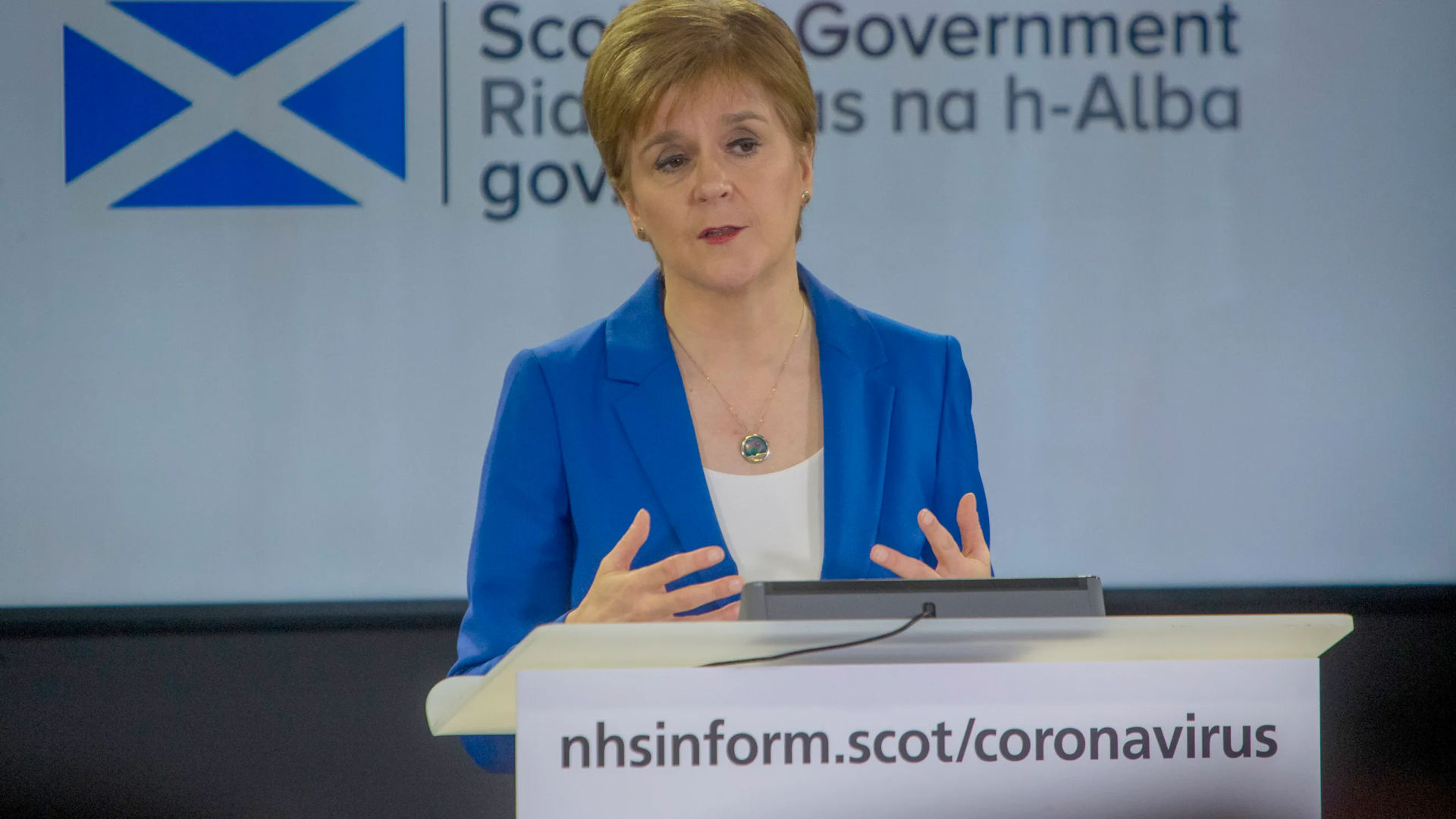
However as you may have noticed, as far as external circumstances are concerned, we’re all living in Rather Strange Times…
NEW FOR THIS EDITION – Updated for the local by-elections that have occured since the last edition of this map was published on 2 Feb 2020, with knowledge seed branches added for all the newly elected councillors (those of the predecessors are retained as sub-branches for reference). Quite a few of elections were scheduled from March to mid May, however only the earliest one took place as planned before the Coronoavirus Crisis caused the postponement of the others. The re-scheduled dates (where set) are in October & November this year, but it will depend on the public health guidance issued by the Scottish Government closer to the time as to whether they will go ahead as planned. Either way, we anticipate that it will be a wee while before we publish another update of this map.
NEW FOR THIS EDITION – Updated for the local by-elections that have occured since the last edition of this map was published on 25 Jan 2020. Quite a few of elections were scheduled from March to mid May, however only the earliest one took place as planned before the Coronoavirus Crisis caused the postponement of the others. The re-scheduled dates (where set) are in October & November this year, but it will depend on the public health guidance issued by the Scottish Government closer to the time as to whether they will go ahead as planned. Either way, we anticipate that it will be a wee while before we publish another update of this map.

There are 129 members (‘MSP’s’) of the Scottish Parliament, elected by a mixed member proportional representation (MMP) system – 73 are elected to single member constituencies by ‘first past the post’, with the other 56 being elected by a 2nd vote to 8 additional member regions, with the outcome dependent on the results for the political parties of the 1st vote in the region’s constituencies. Elections happen every 5 years, with the last happening in May 2016.
Though these politicians fundamentally affect our lives on a day-to-day basis through supporting their party’s policies, and their participation in, and oversight of, government and the essential services that keep the nation going, it’s difficult to get the big picture AND the detail, AND how both have changed over time, in the one source. This first ever political knowledge atlas of the members, constituencies & electoral regions of the Scottish Parliament helps solve that problem.
NEW FOR THIS EDITION – Updated for the local by-elections that have occured since the first edition of this map was published on 9 October 2020. This includes links to the resources on the newly discovered Who Can I Vote For? by Democracy Club website, which contains crowd-sourced details of all the candidates standing in each ward or constituency at every UK local & parliamentary election / by-election since 2016.
NEW FOR THIS EDITION – Updated for the local by-elections that have occured since the first edition was published on 30 September 2019. This includes the resources on the newly discovered Who Can I Vote For? by Democracy Club website, which contains crowd-sourced details of all the candidates standing in each ward or constituency at every UK local & parliamentary election / by-election since 2016.
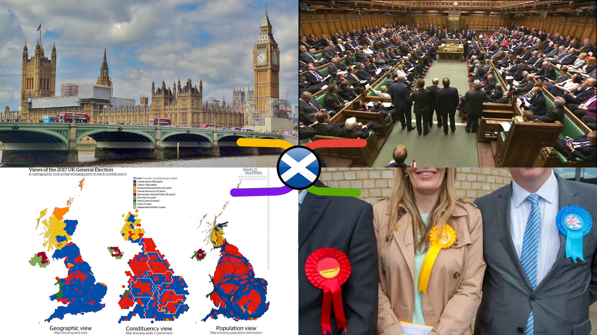
There are 59 Scottish members (‘MP’s’) of the United Kingdom Parliament at Westminster out of a total of 650, elected every 5 years or so (very roughly speaking). Though these politicians fundamentally affect our lives on a day-to-day basis through supporting their party’s policies, and their participation in, and oversight of, government and the essential services that keep the nation going, it’s difficult to get the big picture AND the detail, AND how both have changed over time, in the one source. This first ever political knowledge atlas of the members & constituencies of the UK Parliament in Scotland helps solve that problem.
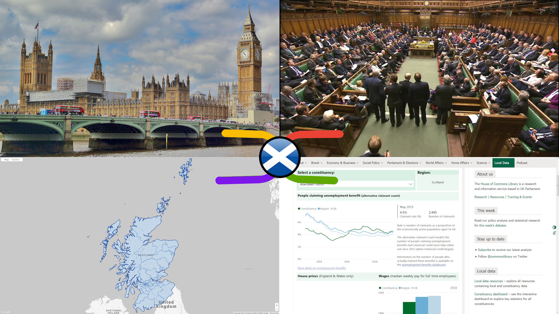
Scotland has 59 out of the total 650 consituencies that make up the United Kingdom Parliament at Westminster, to which a single member (‘MP’) is elected every 5 years or so (very roughly speaking). Obviously this is a political process with an unpredictable outcome, but this map is about visually connecting the general, geographic & electoral knowledge resources about the consituency that remain valid no matter who is currently elected.
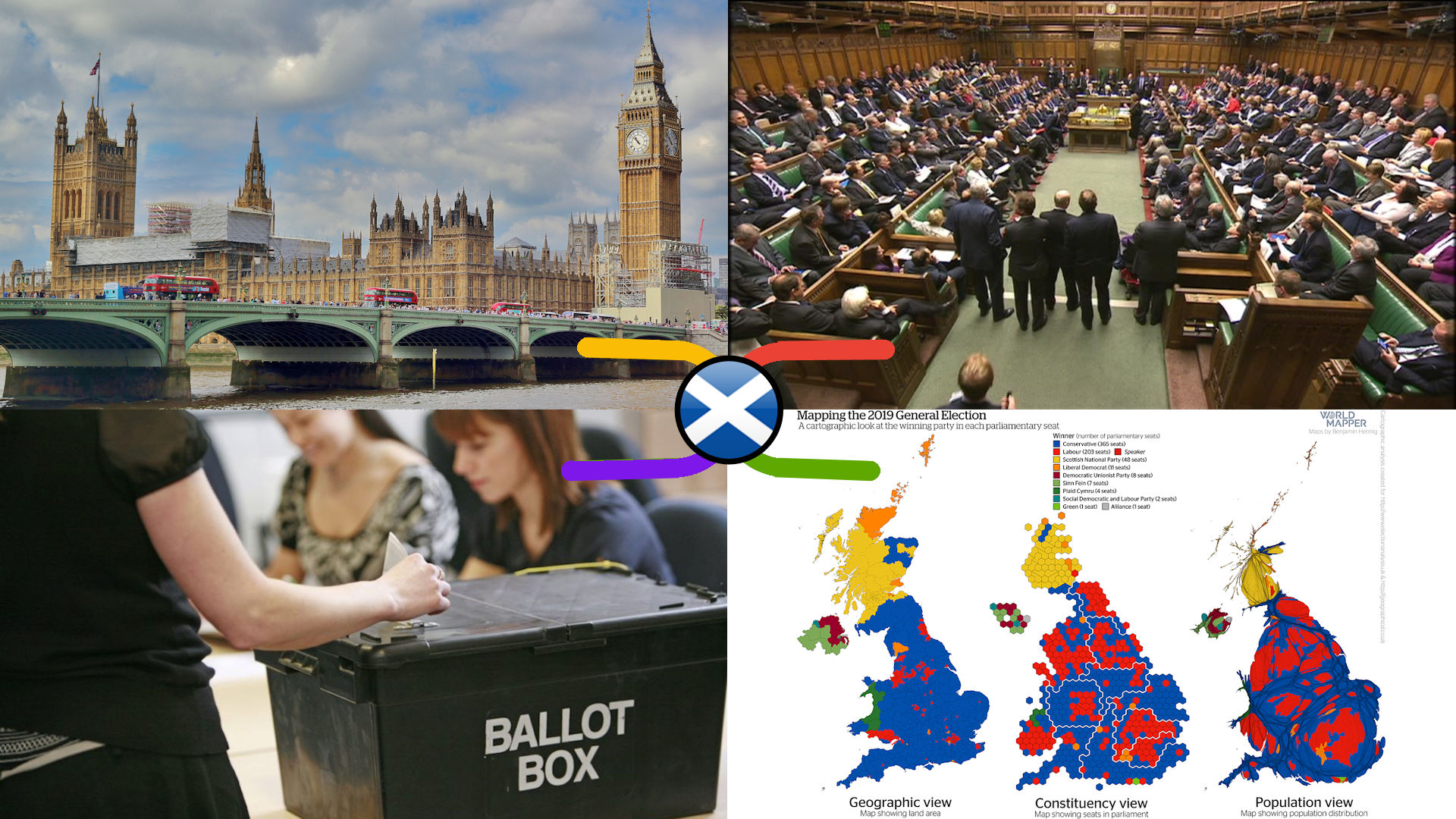
It’s all over bar the shouting for another 5 years (aye, right!), so we can now update our 2019 UK Parliament General Election CANDIDATES Knowledge Atlas with the actual RESULTS, now that all of Scotland’s 59 constituencies have declared.
So all the previously blank cells in the embedded recent election results spreadsheets have been filled in for each Scottish constituency, the successfully elected candidate seed branches ‘flagged & tagged’, and their shiny new majorities embedded as single data fields.
However though the UK Parliament will open it’s doors again on monday the 16th of December, it will take a few days for each victorious candidate to be sworn in as an MP, and so officially re-constitute it. It will then take several weeks for all the online knowledge resources to catch up, especially for the new MPs elected for the first time. Thus even though it won’t take long to publish an updated version of our General, Geographic & Electoral Knowledge Atlas for Constituencies, we wll have to leave it for a month or so until mid January 2020 before we can publish an updated version of our Scottish Constituencies & Members – Political Knowledge Atlas, but in the meanwhile this map will tell you “who’s who and who’s new, doon the road in the Big Hoose”, with all the embedded and attached knowledge resources still available for those who have been previously.
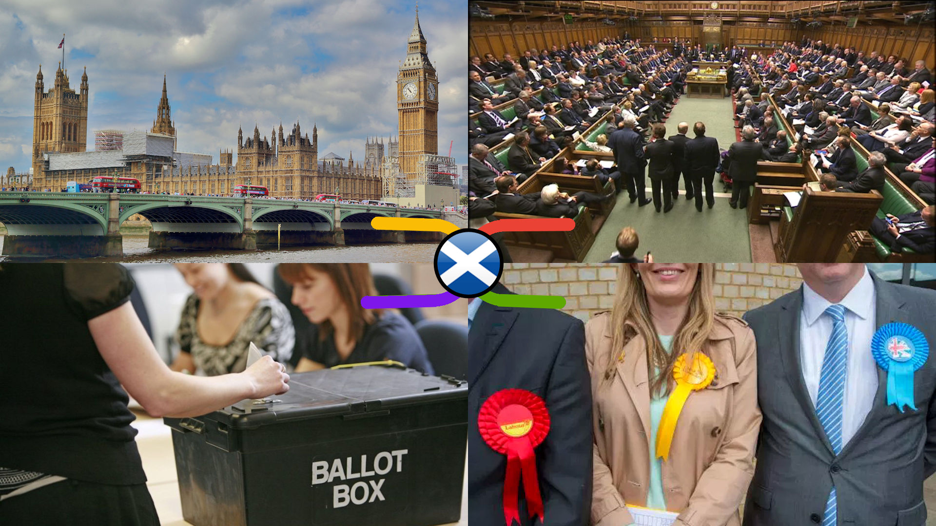
Candidate nominations for the 2019 General Election closed at 4pm on Friday 11th November, 7 days after the parliament was dissolved (view the whole election timetable here). But who’s standing in your constituency, and what do they stand for? This map helps you find out as it includes links to all the knowledge resources you need about all the candidates standing in Scotland.
There are 59 Scottish members (‘MP’s’) of the United Kingdom Parliament at Westminster out of a total of 650, elected every 5 years or so (very roughly speaking). Though these politicians fundamentally affect our lives on a day-to-day basis through supporting their party’s policies, and their participation in, and oversight of, government and the essential services that keep the nation going, it’s difficult to get the big picture AND the detail, AND how both have changed over time, in the one source. This first ever political knowledge atlas of the members & constituencies of the UK Parliament in Scotland helps solve that problem.
Scotland has 59 out of the total 650 consituencies that make up the United Kingdom Parliament at Westminster, to which a single member (‘MP’) is elected every 5 years or so (very roughly speaking). Obviously this is a political process with an unpredictable outcome, but this map is about visually connecting the general, geographic & electoral knowledge resources about the consituency that remain valid no matter who is currently elected.
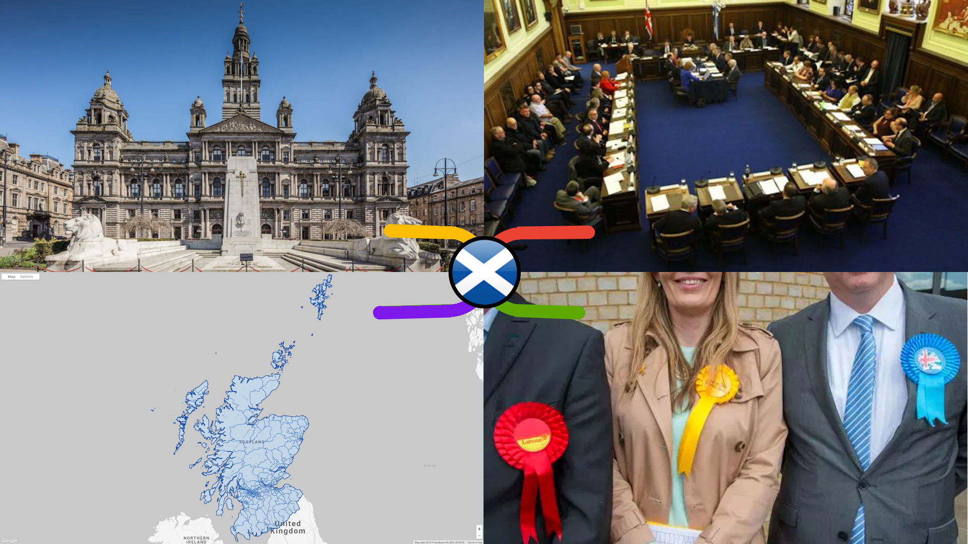
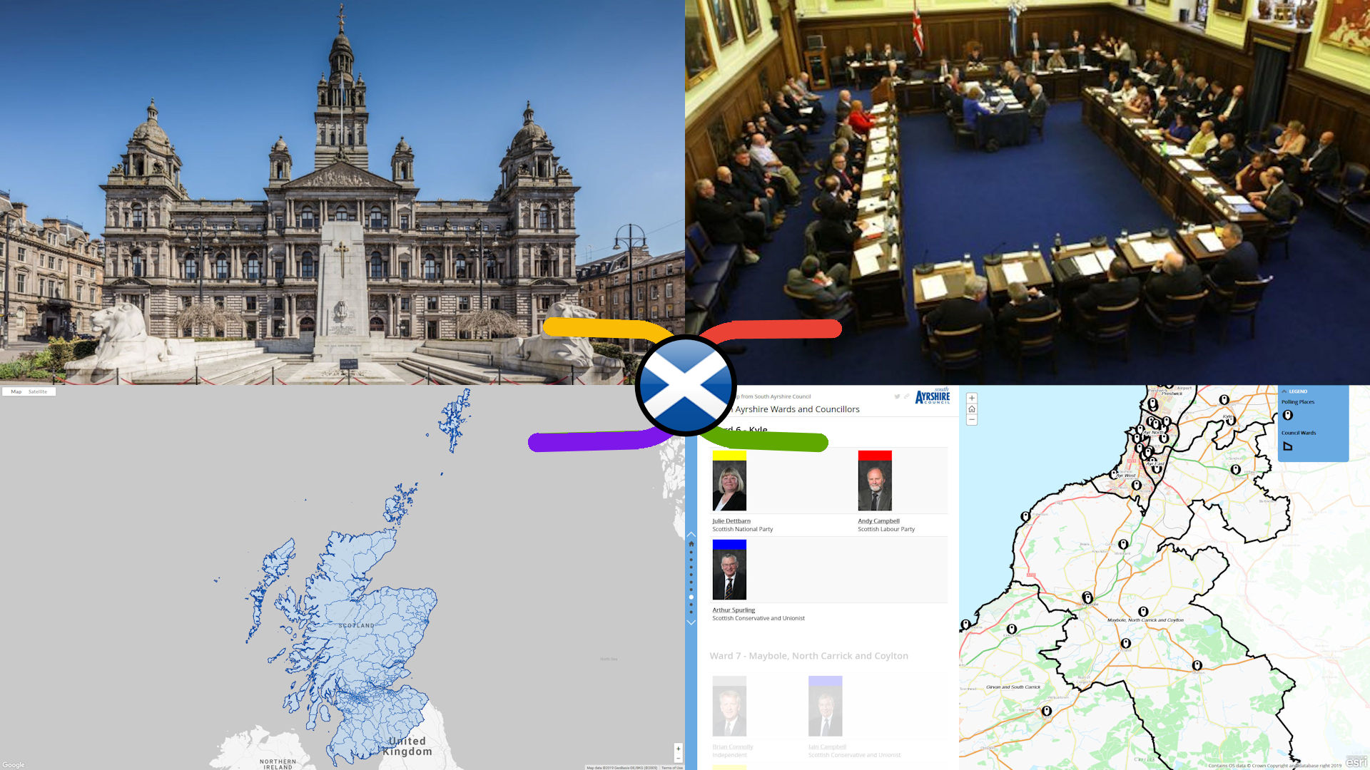
There are 1,227 Local Councillors elected to 354 multi (3 or 4)-member Electoral Wards in Scotland’s 32 Local Councils every 5 years. Though these politicians fundamentally affect our lives on a day-to-day basis through enacting their own party’s local policies, and their oversight of bodies delivering essential services at the local level, it’s difficult to get the big picture AND the detail, AND how both have changed over time, in the one source. This first ever political knowledge map of Scottish Local Government helps solve that problem.
There are 354 Electoral Wards in Scotland’s 32 Local Councils, to which 3 or 4 local councillors are elected every 5 years (the last Scottish National Local Election was 4th May 2017). Obviously this is a political process with an unpredictable outcome, but this map is about connecting the general, geographic & electoral knowledge resources about them that remain valid no matter who is currently elected.